Maps & Geospatial Analysis · 2023
Contraflow Riding on One-Way Streets
Background
Tel Aviv's Florentine neighborhood is a dense grid of narrow one-way streets typical of older urban fabric. As shared e-scooters spread, enforcement reports flagged riders frequently traveling against traffic — a safety concern for riders and pedestrians alike. This analysis measured how much contraflow riding was happening, where, and by whom.
Map — Florentine Contraflow Analysis
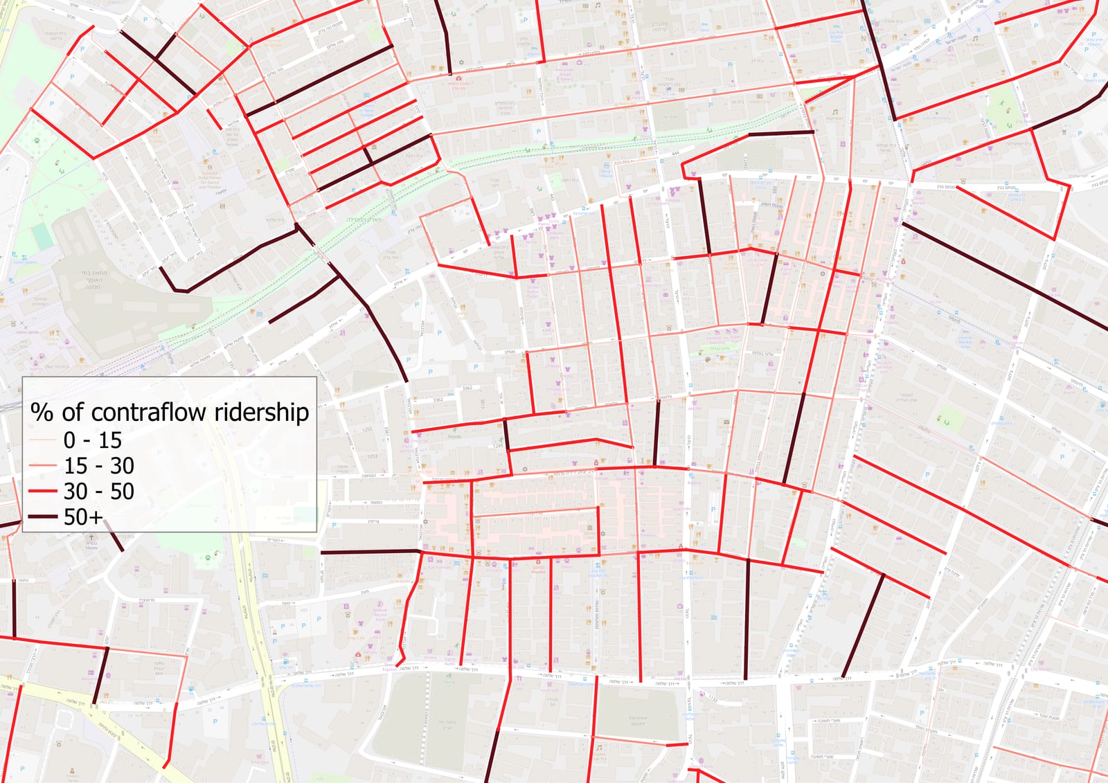
Shared e-scooter trip segments classified as contraflow (against one-way direction) in the Florentine neighborhood, overlaid on the street network.
Methodology
- Pulled GPS trip data from Populus and directional street geometry from OpenStreetMap.
- Used GeoPandas and Shapely to map-match each trip to its street segment and compare its bearing against the permitted direction.
- Flagged trips as contraflow when bearing deviated beyond a threshold (filtering GPS noise), then aggregated by street, time of day and operator.
- Produced final cartography and classification in QGIS.
Results
Contraflow riding concentrated on a handful of corridors, giving enforcement a precise target list instead of a citywide guess. Cross-referencing those corridors with the city's cycling plans also surfaced strong candidates for new contraflow bike lanes.