Maps & Geospatial Analysis · 2025
Near-Home Parking: Shortest-Path Lot Assignment Model
Background
Tel Aviv's "Near-Home Parking" policy gives residents priority overnight access to nearby municipal lots. As it expanded, the city needed to decide which streets map to which lot — the existing boundaries were hand-drawn and ignored real walking distances. This project built a spatial model to assign every street to its nearest lot while balancing demand.
Maps
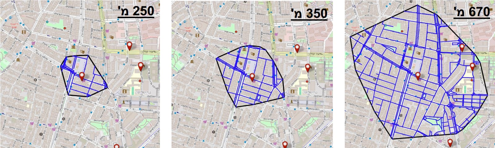
Initial service area computation for a single lot, shown at three stages of network expansion (250 → 350 → 670 addresses, up to a 750 m walking-distance ceiling). The model grows the catchment outward along the street network until it reaches equilibrium — balancing the lot against local demand and competing alternatives. A tighter final area signals a high-demand location with few nearby options; a larger one reflects lower pressure or more alternatives.
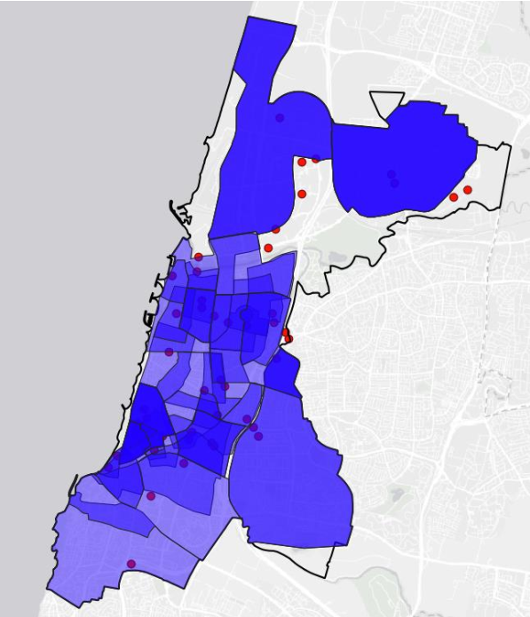
Model-derived service areas across the city. Each polygon is the catchment assigned to one lot by the shortest-path model; overlap zones reveal where competing lots split demand.
Methodology
- Street network: Extracted the pedestrian network from OpenStreetMap with OSMnx, weighted by real walking distance.
- Shortest-path assignment: Computed walking distances from every address to all lots with NetworkX, assigning each street to its closest option.
- Capacity balancing: Re-routed overflow demand to the next-nearest lot once capacity was reached, across 12 rounds as new lots joined.
- Load index: Scored each lot by assigned demand relative to capacity, flagging those under pressure.
- Service areas: Derived catchment polygons directly from the assignment output, replacing the hand-drawn boundaries.
Results
The model's lot assignments and service-area boundaries were adopted into the municipality's production system — replacing the hand-drawn map as the operational basis for the policy citywide.