Maps & Geospatial Analysis · 2023
Who Pays to Park? Mapping Tel Aviv's Parking Equity by Neighborhood
Background
Tel Aviv's curbside parking splits into paid (blue-and-white), free (white-line) and grey regulated zones — and its rollout is politically sensitive, since who pays tracks closely with neighborhood demographics. This project mapped that distribution to answer one question: is the burden of paid parking falling evenly across the city?
Maps — Parking Type by Neighborhood
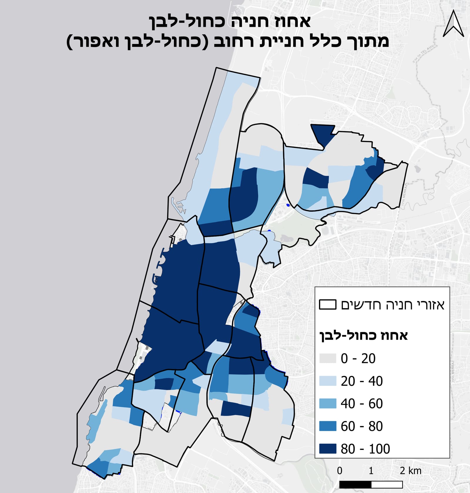
Share of blue-and-white (paid) parking spaces by neighborhood. Darker shading indicates higher proportion of paid curbside.
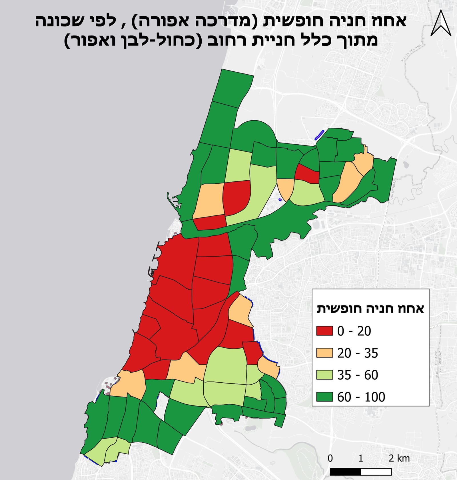
Share of free (unpaid) parking by neighborhood — the inverse of the paid parking distribution, highlighting which areas retain the most free curbside access.
Methodology
- Spatially joined the municipal parking inventory to neighborhood boundaries with GeoPandas, computing the share of paid vs. free spaces per area.
- Built choropleth maps in QGIS — Jenks natural-breaks for technical review, simplified manual breaks for committee presentations.
- Tested color palettes for perceptual clarity and color-vision-deficiency accessibility.
Results
The pattern was stark: central neighborhoods are overwhelmingly paid, while peripheral areas retain large shares of free curbside. That portrait now informs committee discussions on the pace and geography of the next rollout phase.