Maps & Geospatial Analysis · 2023
Spatial Equity of Shared Micro-Mobility in Peripheral Neighborhoods
Background
Shared e-scooter operators promised mobility access beyond the city center, but commercial incentives naturally pull fleets toward dense, high-demand zones, leaving peripheral neighborhoods underserved. This analysis tested whether that imbalance was happening in Tel Aviv's Quarter 7, a peripheral, socioeconomically mixed area.
Maps — Quarter 7 Distribution Analysis
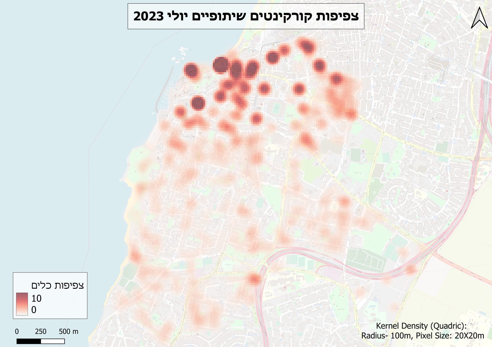
KDE surface — vehicle availability density across Quarter 7.
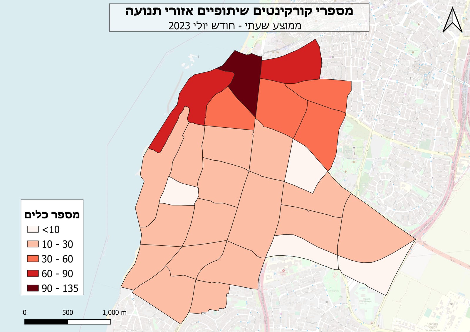
Vehicle counts aggregated to Traffic Analysis Zones (TAZ).
Methodology
- Compiled vehicle-location snapshots from multiple operators via Populus.
- Modeled citywide availability with Kernel Density Estimation in SciPy, selecting bandwidth via cross-validation.
- Aggregated density surfaces to Traffic Analysis Zones (TAZ) with GeoPandas, then computed a supply-vs-demand ratio per zone using trip-origin density as a proxy for demand.
- Produced final classification and cartography in QGIS.
Results
Quarter 7 showed a clear deficit — despite strong trip-origin activity, vehicle availability lagged well behind central quarters with comparable demand. That evidence fed directly into redistribution requirements in the city's operator-licensing process.